
Guidebook for Eikedalen
Essentials
This is the local grocery store. Only a 5 minutes drive away. Very good service.
7 lokale inwoners raden aan
Kvamskogen
This is the local grocery store. Only a 5 minutes drive away. Very good service.
In Tysse there is both a Kiwi and Spar grocery store. This is the place to go for a larger selection of groceries. It is also convenient to stop here on your way from Bergen to Eikedalen.
Tysse
In Tysse there is both a Kiwi and Spar grocery store. This is the place to go for a larger selection of groceries. It is also convenient to stop here on your way from Bergen to Eikedalen.
Sightseeing
Fossen Bratte, also called Brudesløret, is located between Norheimsund-Bergen, directly along road Rv7. Just after the Fossen Bratte tunnel there is a sign for Fossen Bratte with enough space to park the car. The first view you will have is a little bit from above with a tremendous view on Fossen Bratte, the river Stuttabollselvi and the mountains aside with still snow on the tops. Fossen Bratte means steep waterfall and that is a statement: The river Eikedalselva thunders down in a single drop over 79 meters.
Fossen bratte
Fossen Bratte, also called Brudesløret, is located between Norheimsund-Bergen, directly along road Rv7. Just after the Fossen Bratte tunnel there is a sign for Fossen Bratte with enough space to park the car. The first view you will have is a little bit from above with a tremendous view on Fossen Bratte, the river Stuttabollselvi and the mountains aside with still snow on the tops. Fossen Bratte means steep waterfall and that is a statement: The river Eikedalselva thunders down in a single drop over 79 meters.
The Steinsdalsfossen has a fall of 50 m and is special because you can walk safe and dry behind it. The fall occured in 1699 when the river changed course. There is a footpath from the car park up to and under the waterfall.
23 lokale inwoners raden aan
Steinsdalsfossen
The Steinsdalsfossen has a fall of 50 m and is special because you can walk safe and dry behind it. The fall occured in 1699 when the river changed course. There is a footpath from the car park up to and under the waterfall.
Entertainment & Activities
For downhill skiing, Eikedalen Ski Center is located only 2 km from the cabin. Eikedalen Ski Center has approximately 30 downhill tracks and the chair lift will take you to an altitude of 940 m.a.s.l.
9 lokale inwoners raden aan
Eikedalen Ski Center AS
108 KråvegenFor downhill skiing, Eikedalen Ski Center is located only 2 km from the cabin. Eikedalen Ski Center has approximately 30 downhill tracks and the chair lift will take you to an altitude of 940 m.a.s.l.
Furedalen Alpin offers 2 large ski tows, each 950 metres. Total capacity is 3050 people per hour. There are 6 alpine slopes which provide a total length of 7.7 km and different levels of difficulty, and there are 205 metres from the top to the large ski tows. The highest altitude at which you can ski is 575 metres above sea level.
6 lokale inwoners raden aan
Furedalen Alpin
Furedalen Alpin offers 2 large ski tows, each 950 metres. Total capacity is 3050 people per hour. There are 6 alpine slopes which provide a total length of 7.7 km and different levels of difficulty, and there are 205 metres from the top to the large ski tows. The highest altitude at which you can ski is 575 metres above sea level.
Aktiven Skiheis AS
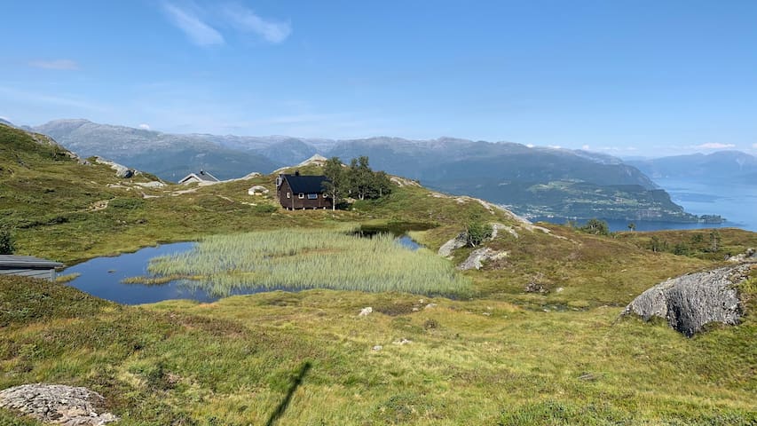
107 SteineThis is a starting point for many of the hikes recommended on this page.
Parks & Nature
This is a simple hike (6 km in total). The tour starts at the road leading to Eikedalen Ski Center along FV7. Follow the road up to the slopes, past the parking lot, where there is a steep section in the beginning of the trail. Follow the trail directly to the lake called Skeiskvanndalsvatnet. Along the trail there are several nice spots with a great view of Eikedalen.
Skeiskvanndalsvatnet
This is a simple hike (6 km in total). The tour starts at the road leading to Eikedalen Ski Center along FV7. Follow the road up to the slopes, past the parking lot, where there is a steep section in the beginning of the trail. Follow the trail directly to the lake called Skeiskvanndalsvatnet. Along the trail there are several nice spots with a great view of Eikedalen.
This is a moderately difficult hike (19 km in total). Start at the entrance of Furedalen Alpin. Follow Mødalsvegen to Mødalen. Then follow the trail to the right towards Tjødnadalen and then to Svartatjørn. There is a steep trail to the top of Såta (very nice view. You can end the trip here if you are too tired to continue all the way). From Såta go to Stoveveggen and on the south side of Gråskorvenuten and into a small canyon before going up to Gråfjellet. Keep to the north of the lake, and walk along the west side. Then you start climbing to the top of Tveitakvitingen.
Tveitakvitingen
This is a moderately difficult hike (19 km in total). Start at the entrance of Furedalen Alpin. Follow Mødalsvegen to Mødalen. Then follow the trail to the right towards Tjødnadalen and then to Svartatjørn. There is a steep trail to the top of Såta (very nice view. You can end the trip here if you are too tired to continue all the way). From Såta go to Stoveveggen and on the south side of Gråskorvenuten and into a small canyon before going up to Gråfjellet. Keep to the north of the lake, and walk along the west side. Then you start climbing to the top of Tveitakvitingen.
This is a rather deep and moderately difficult hike (12 km in total). The hike starts at Aktiven (along Fv7). There is a small parking spot at the ramp. Follow the road to Nedre Steinskvanndalen. Turn right after the bridge and continue to the next bridge. Continue north, and after a few hundred meters, cross a small stream. Follow the red markings.
At the summit you will get a spectacular view towards Fulgafjell in the north east and Lendefjell in north west.
Fotasperrnuten
This is a rather deep and moderately difficult hike (12 km in total). The hike starts at Aktiven (along Fv7). There is a small parking spot at the ramp. Follow the road to Nedre Steinskvanndalen. Turn right after the bridge and continue to the next bridge. Continue north, and after a few hundred meters, cross a small stream. Follow the red markings.
At the summit you will get a spectacular view towards Fulgafjell in the north east and Lendefjell in north west.
This is an easy hike (6,5 km in total). Start at Aktiven (along Fv7) and follow the road to Nedre Steinskvandalen. Then you continue to the very idyllic Steinskvandalsvatnet.
Steinskvanndalsvatnet
This is an easy hike (6,5 km in total). Start at Aktiven (along Fv7) and follow the road to Nedre Steinskvandalen. Then you continue to the very idyllic Steinskvandalsvatnet.
This is a moderately difficult hike (only 1,5 km, but steep) From Norheimsund follow Rv.49 towards Tørvikbygd. Approximately 1 km from the center take a right turn towards Tveit.
You can park at Tveit, or pay a fee (kr 50,-) and drive to Solhaug.
From Solhaug follow the trail to Krokavatnet. Here you will have a fantastic view of the Hardangerfjord.
Krokavatn
This is a moderately difficult hike (only 1,5 km, but steep) From Norheimsund follow Rv.49 towards Tørvikbygd. Approximately 1 km from the center take a right turn towards Tveit.
You can park at Tveit, or pay a fee (kr 50,-) and drive to Solhaug.
From Solhaug follow the trail to Krokavatnet. Here you will have a fantastic view of the Hardangerfjord.
Folgefonna is a collective term for three plateau glaciers in the Hardanger region of Hordaland county, Norway. They are located on the Folgefonna peninsula in the municipalities of Odda, Jondal, Kvinnherad, and Etne. The three glaciers are:
Nordre (northern) Folgefonna, with an area of 26 square kilometres
Midtre (central) Folgefonna, with an area of 11 square kilometres
Søndre (southern) Folgefonna, with an area of 167 square kilometres, making it the third largest glacier in the mainland of Norway.
In total, Folgefonna covers about 207 km2.
The glacier is home to a summer skiing resort, located on its northern region.
51 lokale inwoners raden aan
Folgefonna
Folgefonna is a collective term for three plateau glaciers in the Hardanger region of Hordaland county, Norway. They are located on the Folgefonna peninsula in the municipalities of Odda, Jondal, Kvinnherad, and Etne. The three glaciers are:
Nordre (northern) Folgefonna, with an area of 26 square kilometres
Midtre (central) Folgefonna, with an area of 11 square kilometres
Søndre (southern) Folgefonna, with an area of 167 square kilometres, making it the third largest glacier in the mainland of Norway.
In total, Folgefonna covers about 207 km2.
The glacier is home to a summer skiing resort, located on its northern region.
Everything Else
If you want to visit the Hardanger Fjord, the village Norheimsund is only 20 minutes drive away. Here you can also experience the spectacular view of Steinsdalsfossen waterfall. In Norheimsund there are several interesting shops. In Norheimsund there is a little beach where you can take a swim in the Hardanger fjord or just relax.
11 lokale inwoners raden aan
Norheimsund
If you want to visit the Hardanger Fjord, the village Norheimsund is only 20 minutes drive away. Here you can also experience the spectacular view of Steinsdalsfossen waterfall. In Norheimsund there are several interesting shops. In Norheimsund there is a little beach where you can take a swim in the Hardanger fjord or just relax.